Fort Henry – 1790
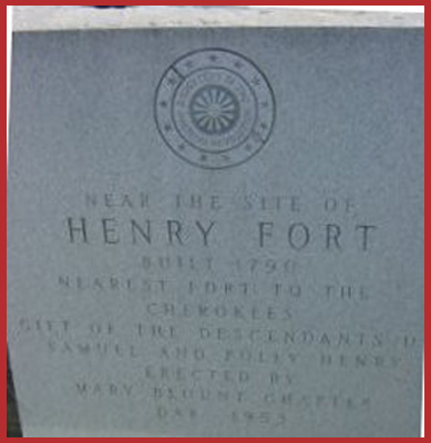
Fort Henry, built in 1790, was the nearest fort to the Cherokees. The original Fort Henry Marker was placed by […]

Fort Henry, built in 1790, was the nearest fort to the Cherokees. The original Fort Henry Marker was placed by […]
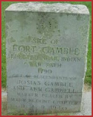
Located near the present Coulter’s Bridge, across from the Little River, on the old Walland Highway, about 6 1/2 miles […]
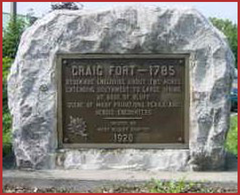
Marker located in Maryville, Tennessee at the corner of Washington and Neff Streets. Dedicated in 1928 by the Mary Blount […]
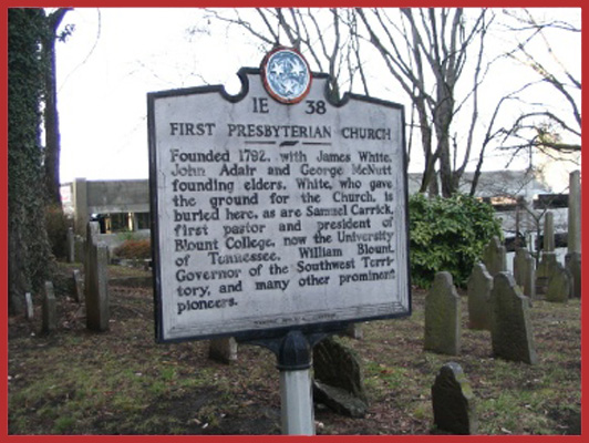
The cemetery is located at 620 State Street, Knoxvillle, Tennessee 37902. This historic site contains the graves of William and […]
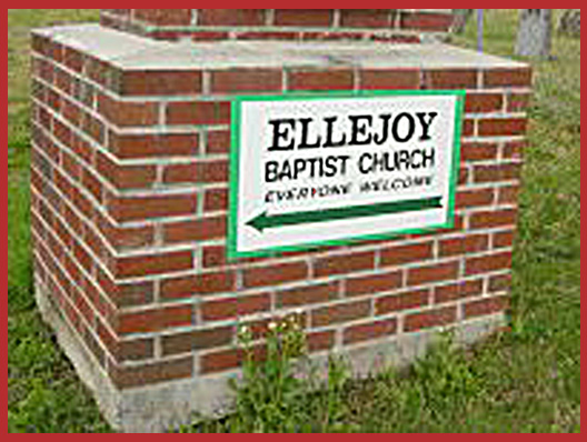
Located 15 miles east of Maryville in the 14th District, Ellejoy Baptist Church was organized in 1823, having met as […]
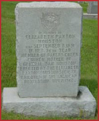
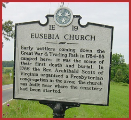
Located at Baker’s Creek Presbyterian Church on Nile’s Ferry Road in Blount County, Tennessee. The marker was placed by the […]
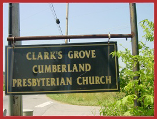
Clark’s Grove Cumberland Presbyterian Church Cemetery is located at 3137 Old Knoxville Highway in Maryville, Tennessee. At least three Revolutionary […]
This cemetery is located in the Chilhowee Primitive Baptist Cemetery “Red Top” in Happy Valley, a community in Blount County, Tennessee. […]
Marker located at Centenary Cemetery, 11 miles southwest of Maryville, Tennessee, on Centenary Road, off Highway 129. The church was formerly […]